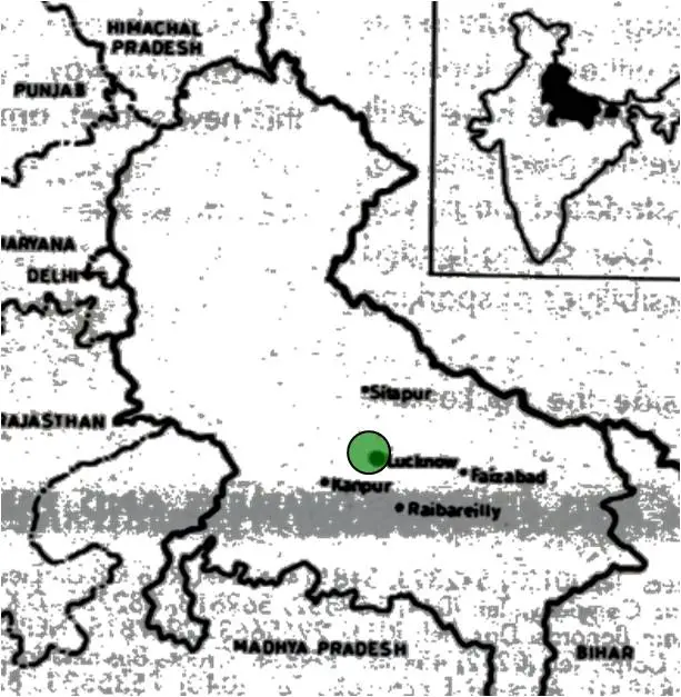
LOCATION
- Latitude: 26.5 degrees to 27 degrees N
- Longitude: 80.5 degrees to 80 degrees; 31 minutes E
- Linked by Four National Highways: 24,25,28,56.
INTRODUCTION
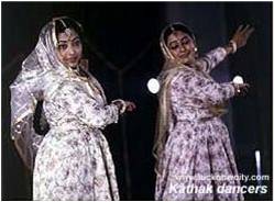
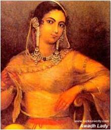
Lucknow is known all over the world for the tehjeeb or the courteous behavior of its people. It is a rare city. Few places in the world are endowed with such rich cultural traditions, as is this romantic city of the nawabs. Whether it is history, architecture, music, dance, handicrafts, etiquette, or sports, Lucknow has its own story to tell.
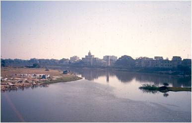
- A river side settlement with the GOMTI river flowing across the city and serving as the backbone to the entire city.
- The river GOMTI is considered to be older than Ganga which is why it is also called “Adi Ganga” in purans.
- The climate is of the sub tropical monsoon type.
- Does not experience long springs and autumns.
- Summers and winters are also not extreme.
- Derived its name from Lakshmana
- 1033 A.D- Legendary invasion of Saiyed Salar Masud deputed by his uncle the Mahmood of Ghazni
- 1400 A.D- Arrival of Bais dominion
- 1526 A.D- Humayun occupied Lucknow
- 1590 A.D- Aurangzeb visited Lucknow and built the Teele Wali Masjid.
- Between 1600-1700 A.D – No. of Pathans settled at Lucknow.
Lucknow under Nawabi Rule
- 1732 A.D – Mohhamad Shah appointed Mohammad Amir Saadat Khan, a Persian adventurer the vice royalty of the area known as Awadh of which Lucknow was a part.
- 1754 A.D – Shuja-ud-duala succeeded Safdarjung during whose reign onwards the Nawabs gradually surrendered their independence.
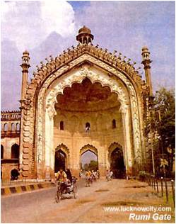
- The rapid growth of Lucknow dates from 1755 when the fourth Nawab Asaf-ud-daula transferred the capital of Awadh from Faizabad to Lucknow.he built the Asafi Imambara, Roomi Darwaza, Residency, Daulat Khana.
- Claude Martin also entered the city during his reign and designed the Constantia.
- 1798 A.D- Sa’adat ali khan succeeded Asaf-ud-Daula and built the Dilkusha, Hayat Baksh Kothi and the famous Lal Baradri.
- 1837 A.D – Saadat Ali Khan’s son Moh. Ali Shah ascended the throne and built the Chota Imambara.
- 1842 A.D – Amjad Ali shah ascended the throne during whose reign the east India company was anxious to control the events in the Awadh area. Relatively little was built in the next decade .
- Now there was almost two cities.
- The old medieval heart centered around the Chowk
- The new city of palaces along the southern banks of the river Gomti.
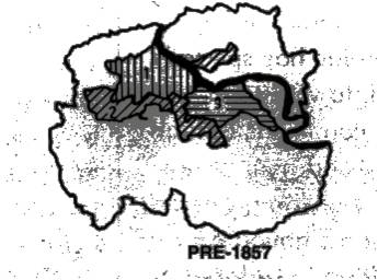
Lucknow in 1856
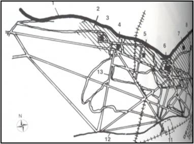
- River Gomti
- Area of demolition
- Imambara
- Machi Bhavan
- Residency
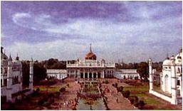
- Quaiser Bagh
- Shahnajaf Imambara
- Botanical park
- Wingfield park
- Cantonment
Lucknow under the Colonial Rule
Lucknow became the capital of Awadh and in 1877.
The layout of the city changed under the British rule. Changes included:
- 7 broad roads through the heart of the city.
- Buildings not required between the La Martiner and Gomti were demolished.
- Only a few palaces were left in the core.
- Green lungs were created in the congested part.
- Cantonment and civil lines emerged in eastern parts.
- Cremation grounds were shifted to the edges.
- Hazaratganj was developed as a market place
- Organized municipal govt.’s introduced.
- Architecture of Lucknow witnessed a heavy dose of European influence: Victoria memorial/1887, Lucknow University, Charbagh Railway Station, Clock Tower, Medical College and Council House.
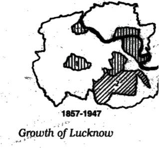
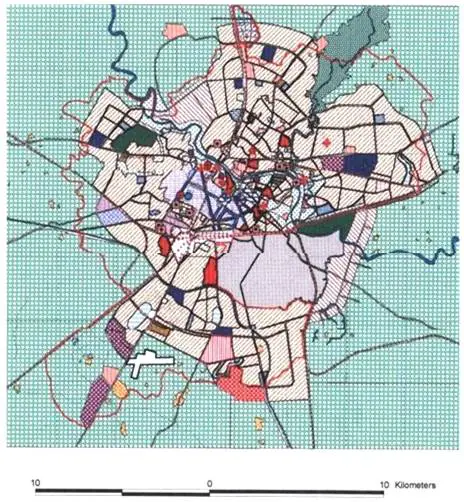
Significant Change in Urban Character
Different ruling powers developed different parts of the city:
- Nawab’s gave the Bagh’s, Ganj’s and Imambara’s to the western and the southern part of the city.
- Britishers gave the cantonment and the railway station to the east and south.
As a consequence of different powers the layering process whereby the new power laid another fabric over the preceding one.
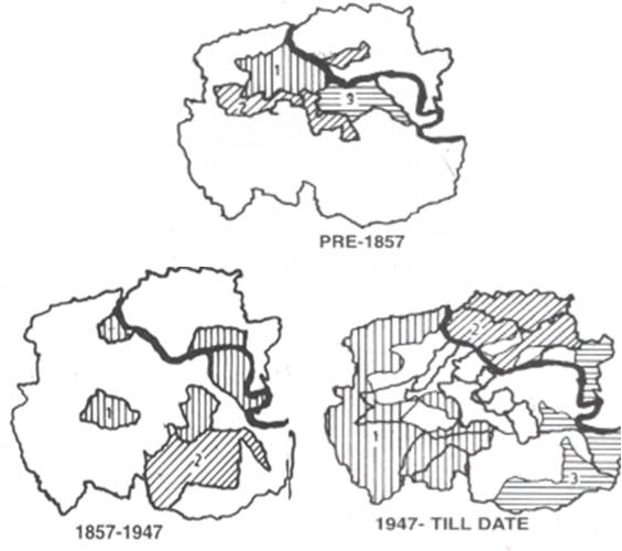
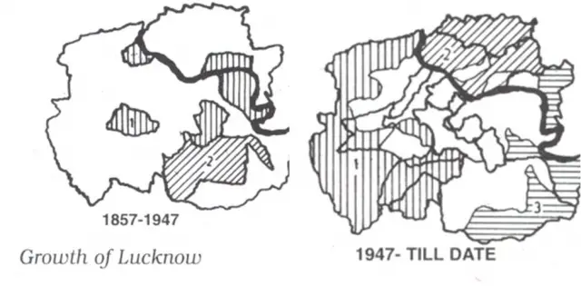
The initial growth of the city started from the west in an area known as the “Chowk” and gradually spread south and south eastwards.
In the early part of the 19th century the city started to grow towards the east with major colonial inputs in terms of the cantonments and the railway station to the south.
During the post independence period a large migrant population settled in the southern part of the city along the Kanpur road.
The 1980’s saw the development of the south-easterly part of the city.
As one travels through the city from the Chowk to the Gomtinagar through Hazaratganj the visual images change.
It is just like travelling in time. One can sharply notice the age old traditions and architectural styles still being maintained in the core of the city- Chowk, these traditions and styles merging with the European styles in Hazaratganj and these styles changing according to modern theories, concept and technologies in Gomtinagar.
CHOWK
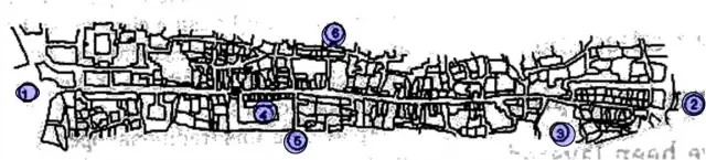
- Gol Darwaza
- Akbari Darwaza
- Tehseen Mian Ki Masjid
- Darul Shafa
- Phool Wali Gali
- Firangi Mohalla
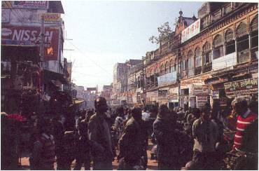
- It is the traditional core of the pre-industrial, pre-colonial city lies in the geographical west of the city.
- Parts of it demolished in the aftermath of 1857 for establishing a public park.
- Half a mile stretch between two gateways of Gol Darwaza and Akbari Darwaza was an active commercial route to Kanpur, Agra.
Significant Characteristics
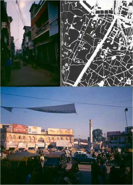
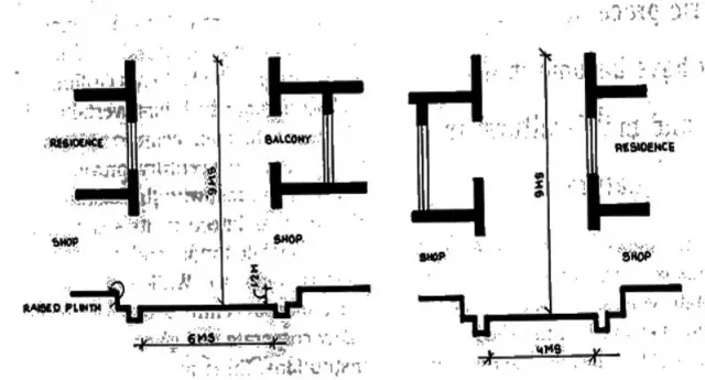
- Strong sense of enclosure is stimulating and is filled with rich aromas and vibrant colour.
- Has mixed land pattern with it’s main spine being fully commercial while the secondary and tertiary lanes being residential.
- The road width–height ratio gradually decreases due to it’s narrowing from primary, secondary, and tertiary but the height remaining the same.
- Projecting balconies ornamented with carvings remind of the Mughal jharokha.
- Coloured glasses as the fan light show the gothic influence under the British.
- Plain corbelling also depicts the British influence.
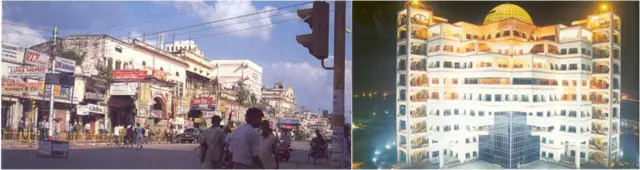
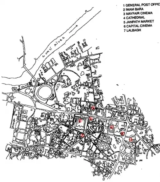
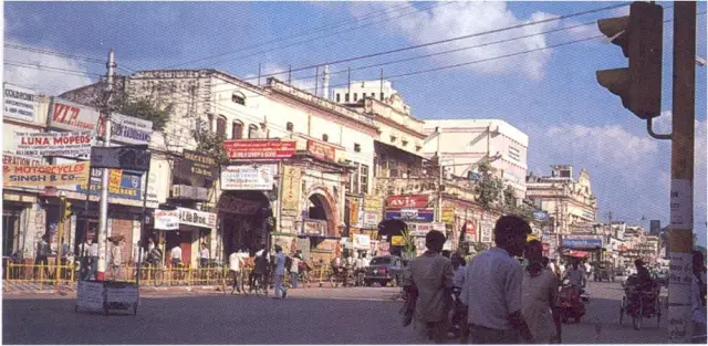
HAZRATGANJ
- Predominatly a commercial centre
Many corporate and govt. institutions cinema theatres like Sahu and Capital.
Eating joints and hang out places.
- Residences of elite at a distance in civil lines.
- Institutions like town hall building civil hospitals and the Vidhan Sabha,General post office have been built over a period of time.
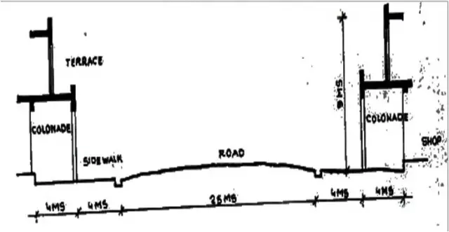
Colonnaded European Architecture:
- It’s spacious feel, automobile traffic and the somewhat western ambiance.
- The street width between 25 to 30 mts. the vertical to the horizontal ratio is 1:3.
- Attracts people who come to enjoy it’s vibrant urban feel. Ganjing or promenading is an activity itself.
- Contains a public realm with a centralized network of institutions and facilities where growth occurs.
- Public spaces here are open and accessible to all.
- The basic idea for the development of this area was it’s close proximity to the cantonment being developed by the British for their own existence.
- Also it’s was close to the previous city centre being the Chowk.
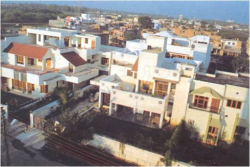
GOMTINAGAR
- Initially the development was only happening to the south of the city, but as time progressed it started spreading towards the north eastern side as well when settlements like Gomtinagar came into existence.
- It is the latest development pertaining to the expansion of the city.
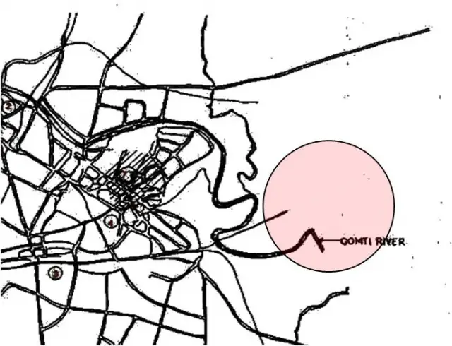
- Lies in the south eastern part of the city on the left of the river Gomti.
- On it’s north lies the locality of Indrangar National Highway 28 (Faizabad Road) divides the areas of Indranagar and Gomtinagar.
It is quite well linked with the rest of the city –
Gomti Bairaj linking the settlement to the main city
Bridge spanning the river connects it to Nishatganj.
Leave a Reply
You must be logged in to post a comment.