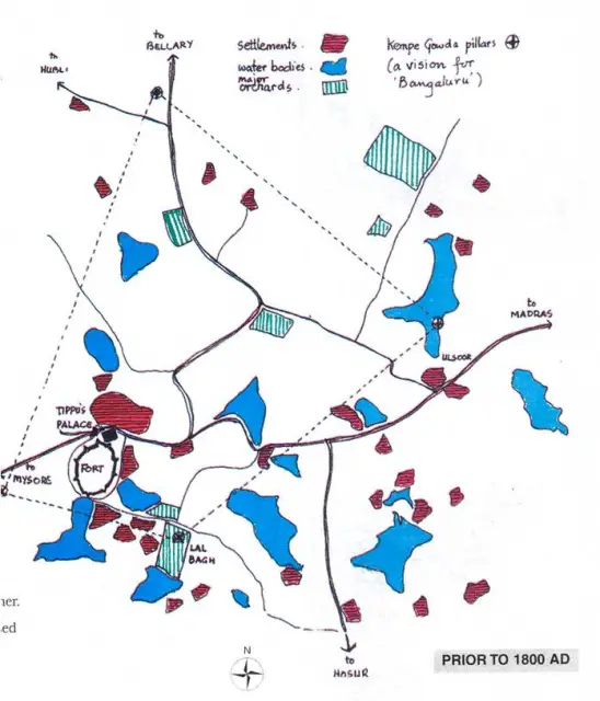
- Bangalore was founded by the Vijayanagar Chieftan, Kempe Gowda in the early 16th century.
- Then called Bangaluru it was a fort of modest dimensions with mud as the main building material.
- Bangalore is India’s 6th largest city and is also called the garden city of the country.
- Myth has it that Bangalore got its name from a humble meal of boiled beans, which a lost and famished king of the Vijayanagar empire, received at the hands of a kind woman. The king called the place Bendakaalu ooru. In Kannada (local language) “Benda kaalu” means boiled beans, “Ooru” means village. Bendakaalooru eventually became Bengalooru, and in English, Bangalore.
- The city primarily grew around 2 nuclei; 1 being the old city on the western side and the new cantonment on the eastern side.
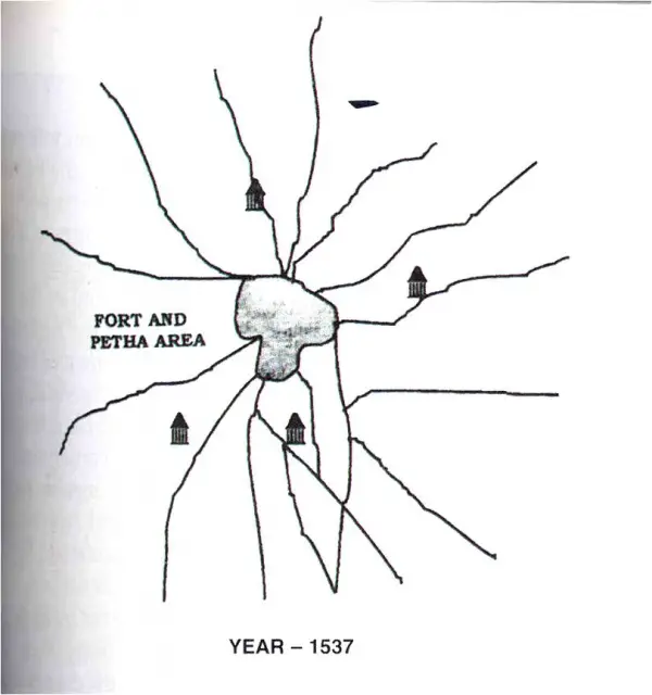
- Kempe Gowda came here to expand his domain in 1537. The town, laid out by the founder consists of a mud fort which gave both spiritual and physical protection on the site of the present fort area and a petha or residential locality with two principal streets intersecting at right angles.
- Communities of different professions occupied different areas of the petha as is evident by the names of the streets still used in the old city area.
- Kempe Gowda is stated to have prophesized that the city would grow extensively and erected 4 watch towers each at the cardinal points to mark the limits up to which the city would extend in the course of time. Today one can see these towers situated at Lalbagh hillock, Kempambudi, Tankbund, Palace orchards and Ulsoor tank Bund.
- Prior to the British, Bangalore was on and off for years, the city of what was then known as Mysore state.
- The two cities that is the old city and the cantonment eventually merged to form the present city after the British left in 1949.
- Bangalore became the capital city when Mysore state joined the Indian union in 1956 serving the political, economic and social hub for the entire state of Karnataka.
- The actual pangs resulting from changing trends in urban context of the city metamorphosed only during the late 70’s when the migration of people from various parts of the country went rampant.
- Thus, the pensioners paradise was transformed into a booming Bangalore with urban form becoming more and more complex and disparate.
- 1537- Magadi Kempe Gowda found the settlement of Bangalore
- 1605- Kempe Gowda II expands the fort and demarcates the limits of Bangalore through decorated pillars.
- 1758- With the decline of the Mughal empire Hyder Ali spearheads the Carnatic hegemony and controls south India from Srirangapatnam, reducing the influence of Mysore rulers as subsidiary of British rulers.
- 1759- The weaken Wodeyars gifted Bangalore to Hyder Ali who started expanding the mango orchards at Lalbagh into a garden which later became a famous Botanical garden.
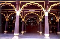
- 1791- Tipu Sultan, son of Hyder Ali further extends and fortifies the fort.
- 1799- With the defeat and death of Tipu Sultan the British formalized a larger state of about 75.4 sq, kms. area with the Carnatic capital shifted from Srirangapatnam to Mysore with focus on Bangalore for trade and manufacture. A mixed use settlement evolves near fort and growth commences to the north of this nucleus, with temples as important foci and tanks as a source of water.
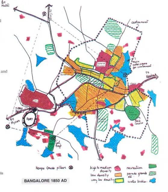
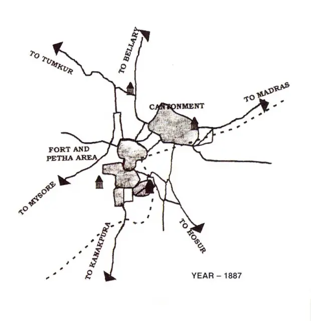
- 1809- A cantonment under direct British rule is created in Bangalore through a garrison near Ulsoor lake. In time it covered almost the entire eastern part of the town.
- 1812- St Marks Cathedral inaugurated as a focus of the cantonment laid out at low density as an emerging garden city with racecourse and other large open spaces.
- 1831- The British established direct rule in the state and shifted the capital from Mysore to Bangalore.
- 1834- All headquarter towns were connected to Bangalore by road.
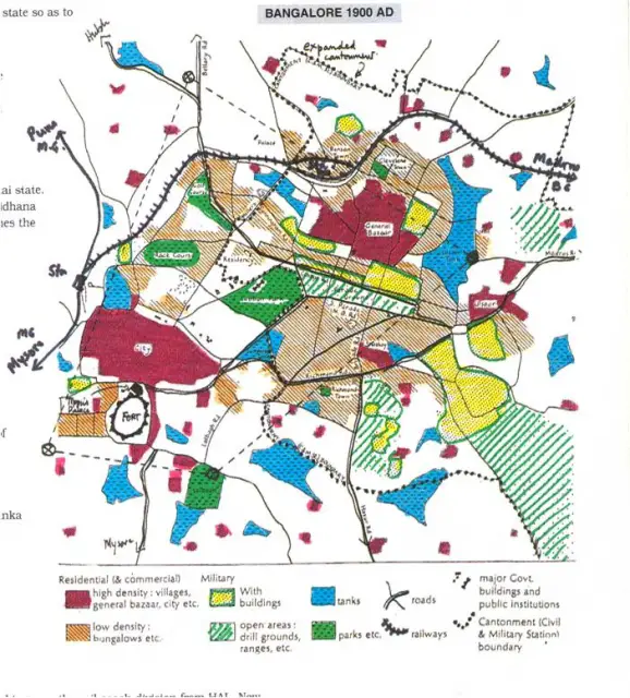
- 1853- Telegraph connection introduced to and from Bangalore and in a little time all the important cities of India were within the reach of the city.
- 1856- A Department of Public Works (DPW) created for public buildings, road construction and maintenance. Within a few years 1600 of new roads and 300 bridges were constructed
- 1859- work commences on bringing Bangalore within the railway system.
BANGALORE 1895 A.D
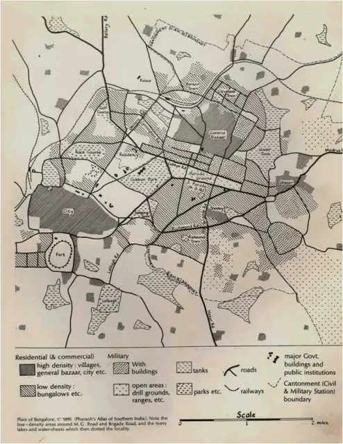
- During 1895 the areas around M.G. road and Brigade road had very low density and there were many lakes and water sheets which then dotted the locality.
- The city then comprised of the residential locality in the north and the fort to the south, both surrounded by a deep ditch with almost impenetrable thick bush necessitating a series of gates which permitted access to it.
- A big market, corresponding to the present day Avenue road, stretched from the north gate to the fort.
BANGALORE TODAY
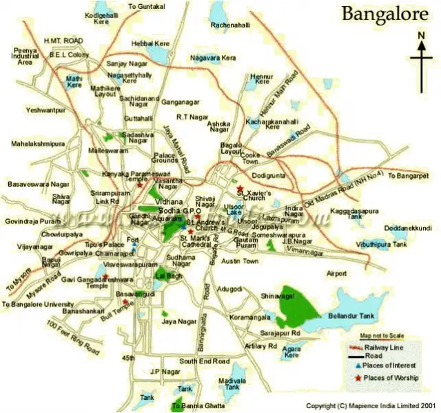
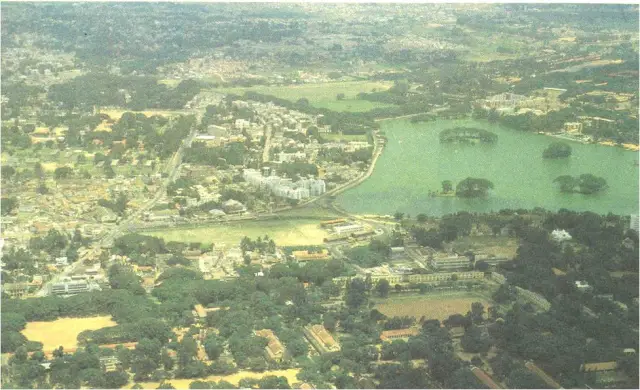
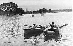
- Bangalore is situated at an elevation of 900m above sea level with a varied terrain collecting rain water at several spots as water tanks.
- It’s climate is similar to the temperate region. This makes the city a fascinating place for a variety of activities, races and lifestyles, a cosmopolitan corral as it is frequently called. Pubs, discotheques, clubs and 5 star hotels co-exist peacefully with traditional buildings.
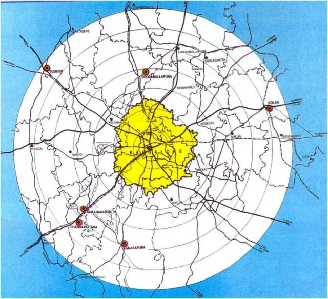
METROPOLITAN ARE BOUNDARY
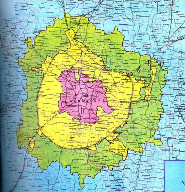
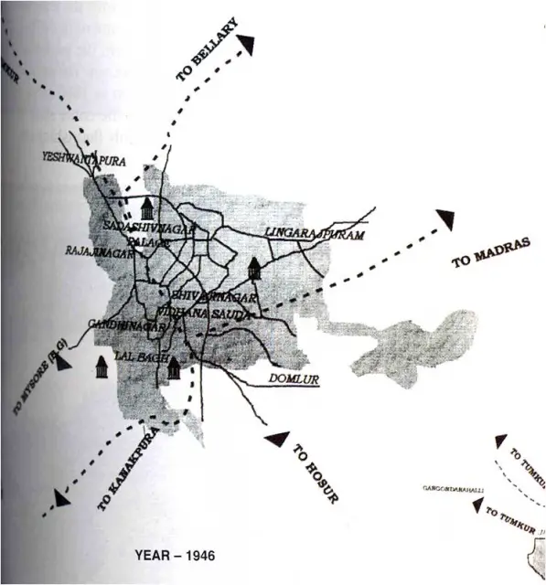
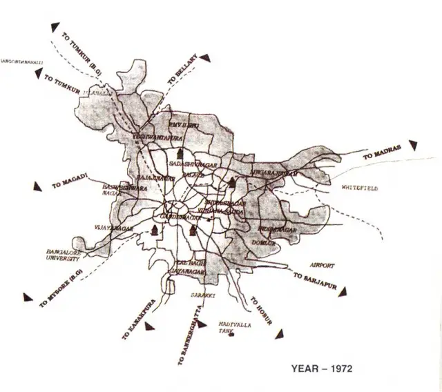
•The size of the city during the period of 1901-1991 extended from 74.72 sq. kms. To 200 sq. kms.
•The same period its population increased 0.16 million to 4.75 million. This unabated spectacular sprawl could be largely due to the lack of natural barriers around Bangalore
BANGALORE AND SURROUNDING REGIONS
![]()
- Bangalore, the fifth largest city in India, has been classified as ‘A’ class city. The growth of the city has been phenomenal in recent years, largely due to unprecedented industrial progress with the establishment of many large, medium and small scale industries and technical and professional institutions of national importance. The industrial development at Hosur in Tamil Nadu near Bangalore and suburban areas has also contributed to the growth of Bangalore.
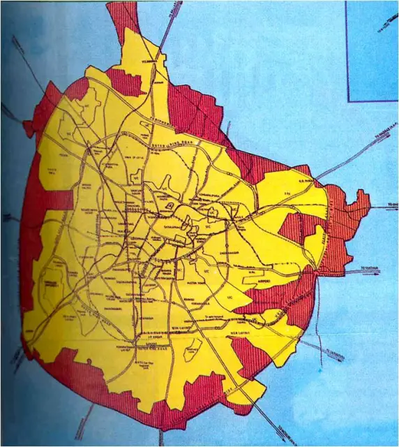
CIRCULAR RAILWAY AND RINGROAD

- Under the British influence, Bangalore bloomed with modern facilities like the railways, telegraphs, postal and police departments. In 1881, the British returned the city to the Wodeyars.
BANGALORE TODAY
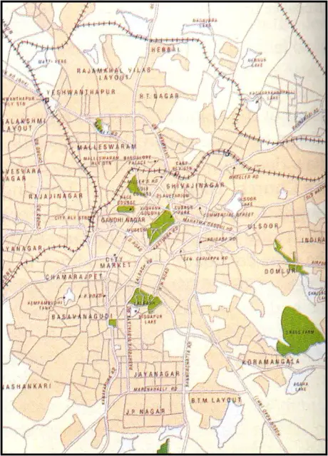
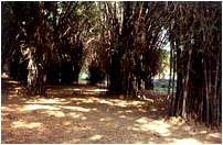
Bangalore is called the garden city of the country for it’s large parks and open spaces in addition to tree lined avenues in almost all parts of the city.
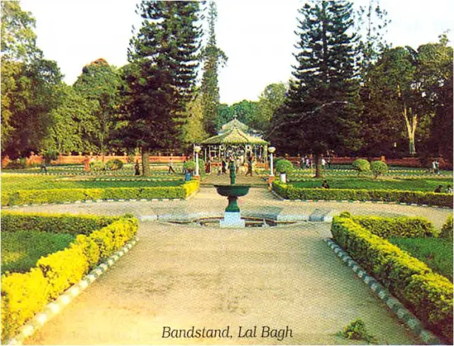
Lalbagh the 120 acre garden and Cubbon park an 80 acre garden are two major green areas of the city.
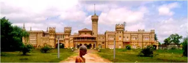
The other lungs of the city are the palace grounds and the golf course within it’s limits.
-
Two miles north-east of central market in the cantonment, are two important business areas.
-
One is along the south side of M.G. Road for a distance of 3-4 blocks including two intersecting streets, specializing in luxury goods and services.
-
The other area, a few blocks north of M.G. Road is a shopping avenue known as the commercial street which is 3 blocks long with goods ranging fron luxury items to household necessities.
-
Public buildings such as municipal building , the main post office, telephone office and the central police station are to the east of the central market.
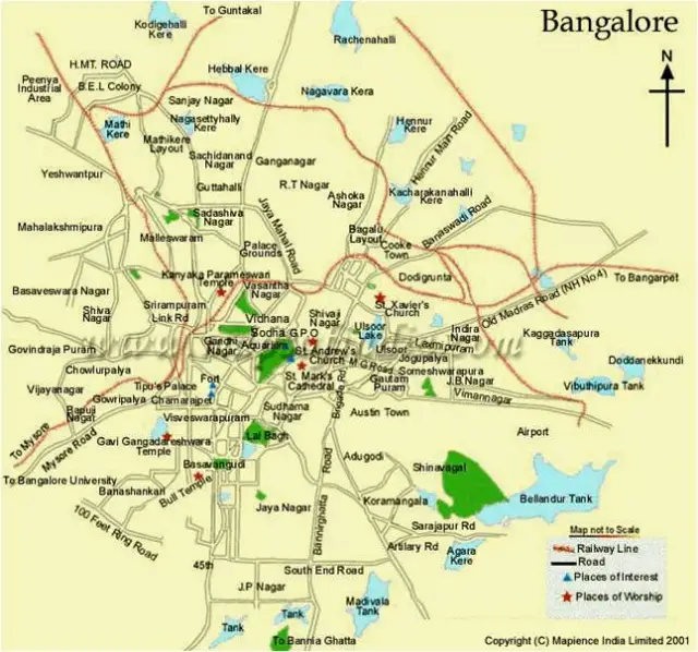
- The cities major hospitals are concentrated on the south side of the market.
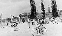
- Many of the public and semi-public institutions are located with in or at the edge of Cubbon Park.
- Residential sites are selected on the basis of racial, cultural and religious preferences.
- Most of the slums are located on or near the periphery of the city.
- The residential areas of upper class and middle class are somewhat centrally located.
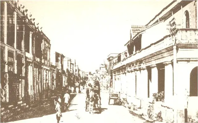
Commercial street as it was in 1920 A.D
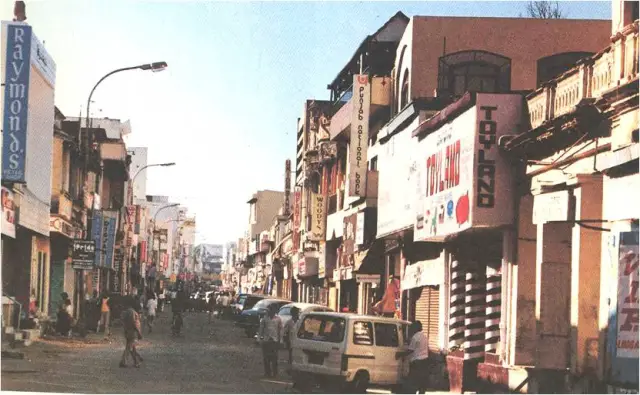
Commercial street as it is today
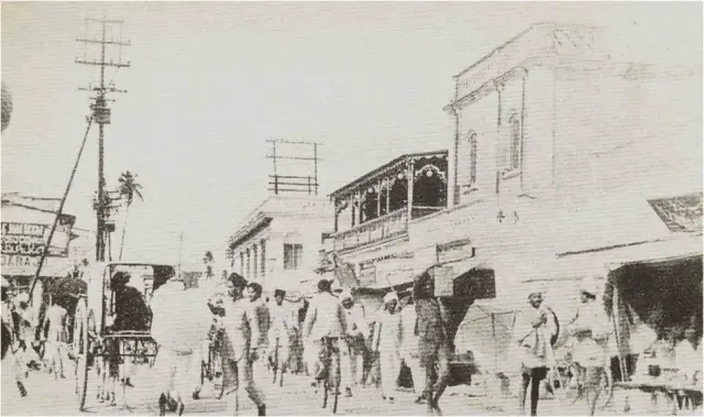
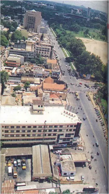
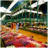
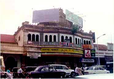
A market scene in Bangalore in 1929
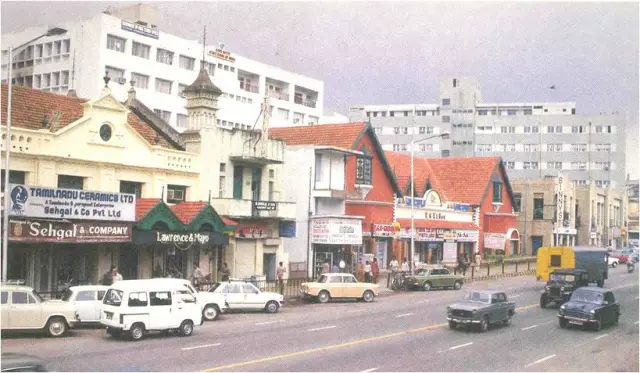
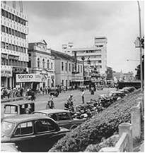
A market scene in 1989 – Mahatma Gandhi road
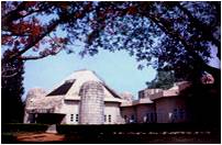
The garden of Lalbagh was laid by Hyder Ali in1759.The name was given owing to its profusion of roses and other red flowers.
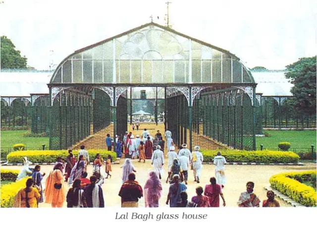
In 1889, Prince Albert Victor of Wales was given a reception in the garden by the Maharaja of Mysore. The prince laid the foundation of the glass house.
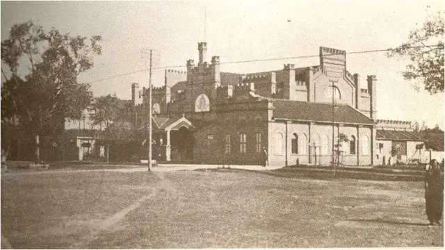
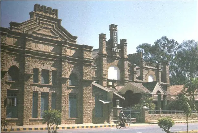
The Theatre on Cubbon Road , 1918.
This stone building was originally designed as a store or a canteen and armory.
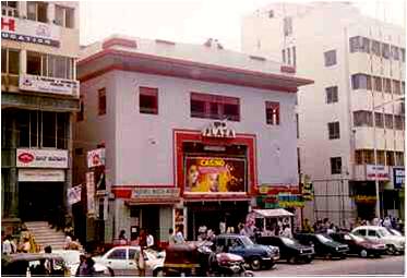
The Plaza, M.G. Road
Leave a Reply
You must be logged in to post a comment.